PROBLEM
The Central Nebraska Public Power and Irrigation District (CNPPID) is responsible for providing irrigation water to over 105,000 acres, electricity generation, flood control, recreational services on more than 26 lakes, and providing and maintaining the lakeshores for over 1,100 private homes and cabins on six lakes. They needed efficiency in managing their services – the integration of their current accounting system with a newly designed GIS database, and to link both databases to their spatial data.
SOLUTION
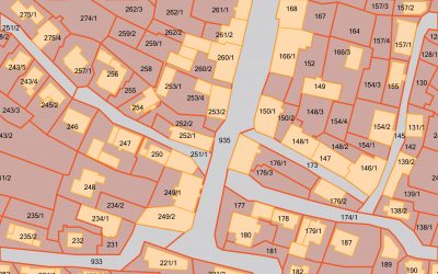
ADC designed and created a brand new GIS database to hold a variety of spatial information about land parcels, permits, violations, and other information necessary for state required reports. The GIS data was structured and organized per their integration and functionality requirements.
RESULTS
Now CNPPID is able to quickly access multiple layers of information through the GIS system, quickly and easily – be it pointing and clicking, or robust input, search, and zoom tools. Their information retrieval and management process has been immensely streamlined.


