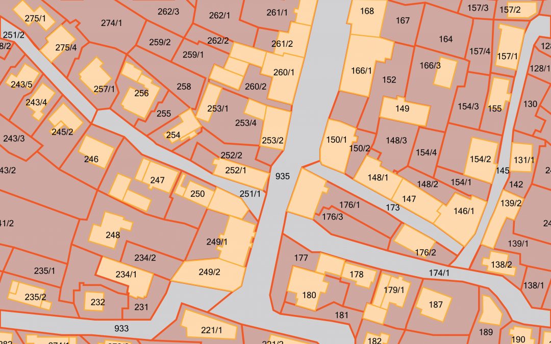
PROBLEM The Barron County Land Information Office had been pursuing a program of land record modernization and GIS integration. ADC has worked with the county from the start, providing the full gamut of GIS-related services, from needs assessment to application and...
PROBLEM The Central Nebraska Public Power and Irrigation District (CNPPID) is responsible for providing irrigation water to over 105,000 acres, electricity generation, flood control, recreational services on more than 26 lakes, and providing and maintaining the...
PROBLEM The United States Army Corps of Engineers (USACE) requested a solution to help manage activities at the 19,800-acre Former Sioux Army Depot (FSAD) facility located in Sydney, Neb. In addition to standard geographic information systems (GIS) tools and...
PROBLEM Washington County, Neb. was seeking to modernize and implement a geographic information system (GIS) solution to provide better inter-government collaboration. In addition, converting and creating parcels was needed to provide accurate and updated layers for...
PROBLEM The Burnett County Land & Water Conservation Department has a number of lake watershed management projects designed to evaluate and reduce the pollutant loads to the lakes. Determining best management practices (BMPs) helps combat phosphorus delivery, one...
PROBLEM Douglas County, Nebraska, which includes the city of Omaha, has over 190,000 parcels, each with an assessment value assigned to it by the County Tax Assessor. This information needs to be distributed to the public as efficiently as possible. SOLUTION The main...