PROBLEM
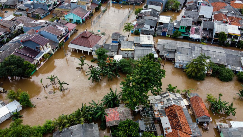
Ruins left in the aftermath of Hurricane Katrina were unrivaled. Katrina desecrated the Gulf Coast, causing $75 billion in damage to 270 miles of coastline, heading inland as far as 103 miles. When the extent of the Katrina damage became fully known, and the recovery effort became long-term, the US Army Corp of Engineers (USACE) needed to look outside its ranks for help. ADC was contracted to provide GIS expertise to Task Force Hope in Mississippi and Louisiana beginning in May 2006.
SOLUTION
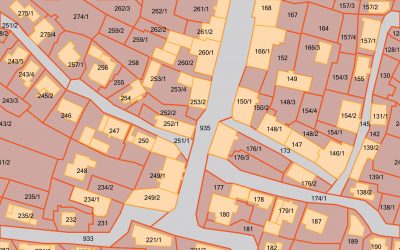
The USACE and FEMA employed GIS to visualize actual damages by analyzing collected aerial reconnaissance and ground truth data. The mission was in full swing when the first ADC personnel arrived on the Gulf Coast. ADC used GIS applications to better document progress, aid in contracting decisions and help crews locate properties in the field. A series of maps was updated weekly for use at commander briefings and local city council meetings. The contracting office used GIS to determine the volume of debris, and set the contracting costs accordingly.
RESULTS
Using GIS, decision makers could see the spatial extent of the damage; learn who was affected by the disaster, and which resources were affected. They used this data to distribute resources and coordinate with other federal and state agencies and organizations. ADC was honored to be involved in an historic cleanup effort of this magnitude.