PROBLEM
The U.S. Army Corps of Engineers was mandated by Congress to identify which properties in the cities of Pierre and Ft. Pierre would be at high risk for flooding due to increasing the standard release rate from the Lake Oahe Dam to generate additional electricity. ADC was called in to conduct data development and modeling to determine the potential urban impact on increasing the flow from the dam.
Using this information, the overall cost to buy out residents was determined by using the land and property values, the cost of impacted utilities, and relocation and demolition costs. The initial study had to be completed within 90 days and required considerable coordination between multiple departments within the U.S. Army Corps of Engineers and the cities of Pierre and Ft. Pierre.
SOLUTION
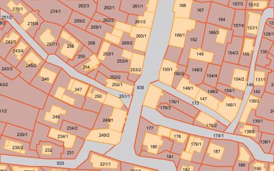
Neither Pierre nor Ft. Pierre had a GIS system, so existing files were obtained from the cities, local utility companies, county sources, including pertinent relational databases. The parcel, electrical line, gas line, sanitary sewer, storm sewer, sewer outlet, manhole cover, survey marker, and street centerline layers all required conversion to a GIS format, and then reprojecting and georeferencing to generate the base data set for the study. The relevant fields from the relational databases were joined to the spatial data. Numerous discrepancies within the database were investigated and corrected, and then digitized and attributed.
The second phase of the project was the modeling of the 100-year and 500-year flood boundaries based on the projected releases from the dam. Over 20 different scenarios were generated and evaluated. Last, the development of the CEDAR (Cost Estimate for Damage After Release) interface was completed. This interface allowed the user to select a flooding scenario and criteria, as well as the land and utilities coverage for the area, projecting cost estimates for damage.
RESULTS
Through the modeling performed by ADC, properties that would be impacted by the flood were identified and reports generated that indicated land value, relocation and demolition costs. This allowed the government to identify and buy out properties in the impacted area, and allowed additional electricity to be generated for this growing area.